


Park is on the right.


AMAZING PHOTOS OF SAN JOSE, CALIFORNIA (1975-2006)
This is a wonderful collection of photographs! It took some research to track down their origin. Here is Gerald J. Greenleaf, Senior Architect of the San Jose Redevelopment Agency, to tell you himself (quoting from his email to me).
"They're part of a powerpoint presentation I made for a Redevelopment Agency Staff meeting last summer (2006).
COMMENTS? loui@louitucker.com
| Photos taken 1975 | Photos taken 2006 |
|
|
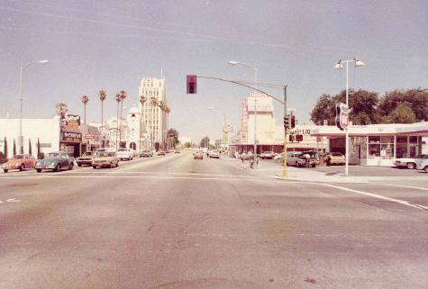
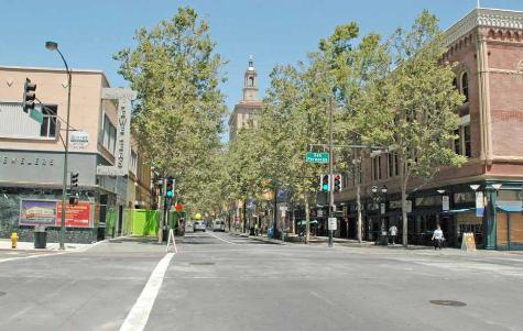
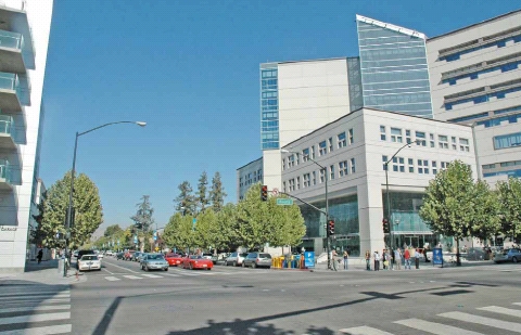
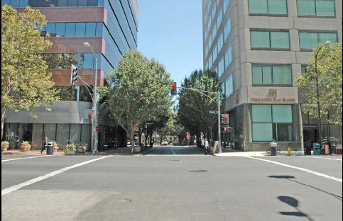
| Santa Clara Street at Fourth looking east -- that's the new City Hall on the right. | |
|
|
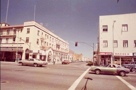
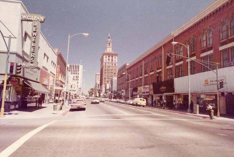
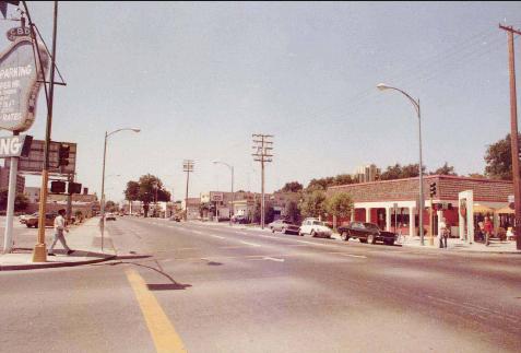
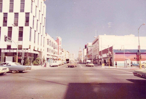
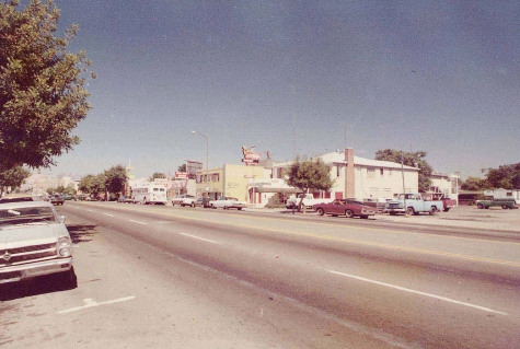
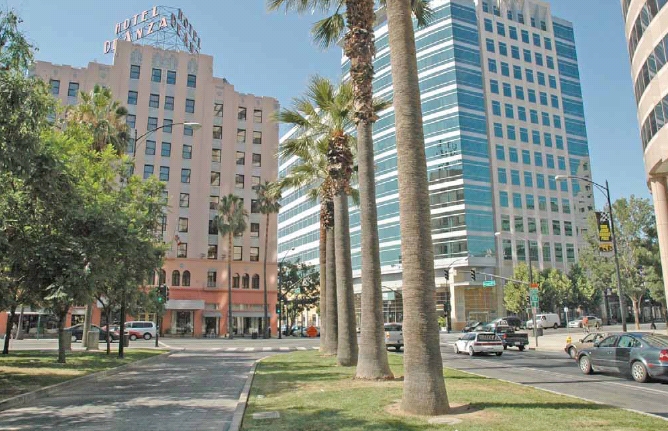
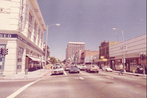
| Santa Clara Street at San Pedro looking west. The De Anza Hotel is still there! | |
|
|
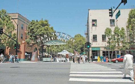
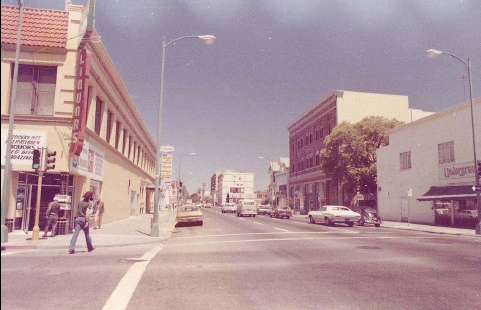
| San Pedro at Santa Clara looking north. When the photo on the right was taken the street was blocked off for a Farmer's Market. | |
|
|
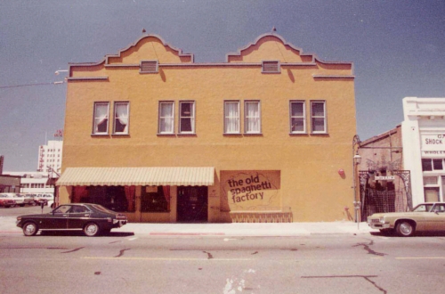
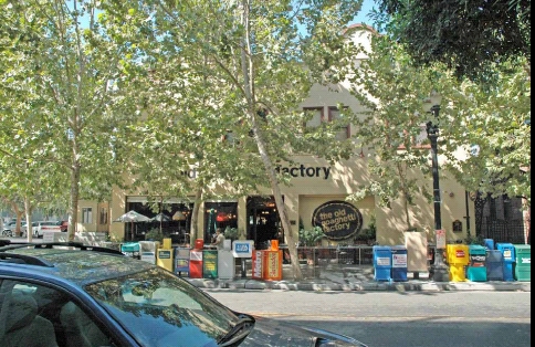
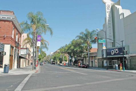
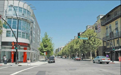
| San Pedro between Santa Clara and St. John looking west. The Spaghetti Factory has survived 30 years. | |
|
|
| South First at San Salvador looking north. | |
|
|
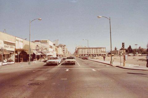
| Market Street at San Fernando looking southeast. The Circle of Palms and the Fairmont Hotel are in the background. | |
|
|
| First Street at San Fernando looking south. That's the back of the Fairmont Hotel on the right. | |
|
|
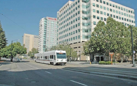
| First Street at San Fernando looking north. Light rail tracks run on the right. | |
|
|
| Fourth Street at San Fernando looking north. The Martin Luther King Library is out of view off your right shoulder. | |
|
|
| San Fernando at Fourth Street looking east. That's the Martin Luther King Library on the right. | |
|
|
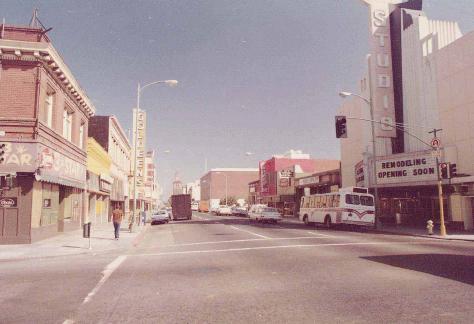
| First Street at San Carlos looking north. The light rail system makes a turn from San Carlos onto First Street here. | |
|
|
| Third Street at San Fernando looking north. And it's still one-way going north at this point. | |
|
|
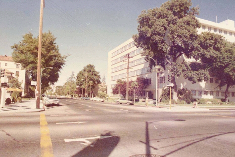
| San Fernando at South Almaden looking northeast | |
|
|
| San Carlos just west of Market looking south. That's San Jose's Convention Center. | |
|
|
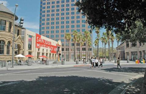
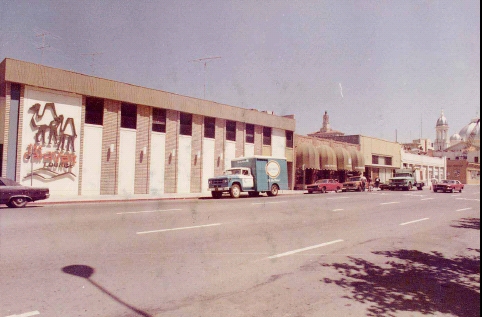
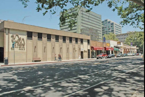
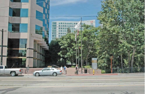
| San Carlos east of Woz Way looking north. The Adobe Systems building in the background.
An entrance to the Guadalupe River Park is on the right. |
|
|
|
| San Carlos at Woz Way looking east. | |
|
|
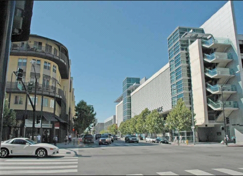
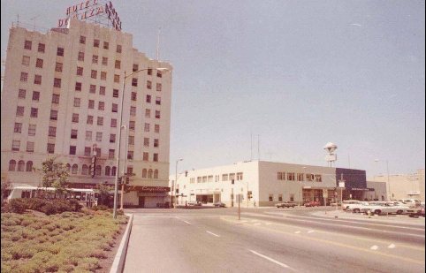
| Almaden Boulevard just north of San Fernando looking north. And the De Anza Hotel is still there! | |
|
|
| South Second Street at San Fernando looking north. The light rail system is coming toward you on the right side of the street (left in this view) | |
|
|
| South Second Street at San Fernando looking east. Light rail track in the foreground, running south at that point. | |
|
|
| San Fernando at Third Street looking east. | |
|
|
| Post Street at Market looking east. | |
|
|
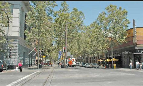
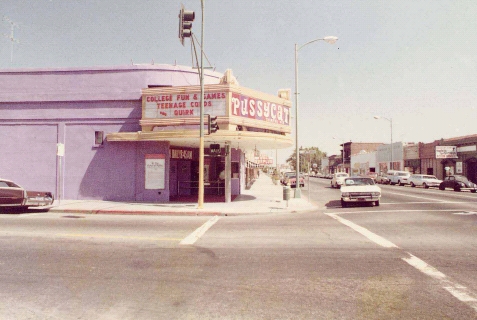
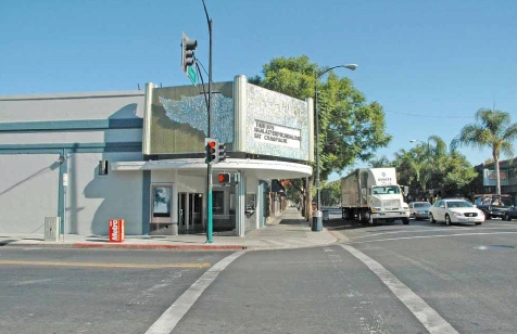
| Fourth Street, between San Carlos and San Fernando, looking west down the Paseo de San Antonio | |
|
|
| Market Street between San Carlos and San Fernando looking east down the Paseo de San Antonio. The Fairmont Hotel is on the left | |
|
|
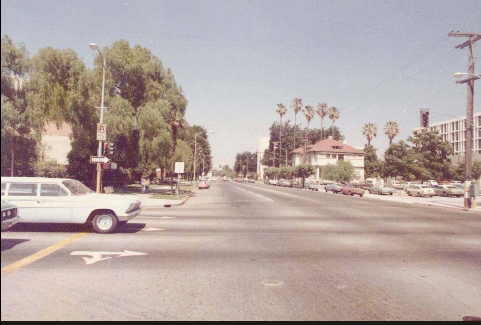
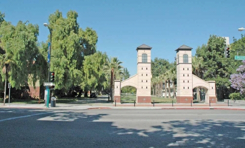
| San Carlos at Fourth Street looking east. You used to be able to drive through San Jose State University campus, and now you can't. | |
|
|
| Second Street at San Fernando looking east. Light rail track in the foreground, running south at that point. | |
|
|
| San Salvador at South First Street looking south. | |
|
|
| Park Avenue at Market looking east. The Fairmont Hotel is in the background. | |
|
|
| Market Street at San Fernando looking northwest. St. Joseph's Cathedral is out of view on the right side of the street. | |
Another email I received as a result of posting this page came from Marc E. Powell, currently a Senior Signal Designer at Hexagon Transportation Consultants.:
From 1978 to 2000, I was a City of San Jose employee working in what is currently the Department of Transportation. In the early 1980's (I can't recall exactly when) I salvaged the box of rolled-up pictures and negatives from office trash. The box sat under my desk for at least 15 years until, shortly before I left the City, I gave it to a Redevelopment Agency employee. Unfortunately, I can't recall his name. At any rate, I was beginning to regret having given away the pictures, since I feared that they had finally made into the "landfill" I had saved them from so many years earlier. I am glad to see that they are safe and are being used for a good purpose.